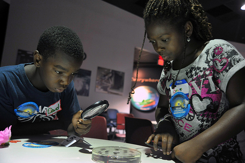
As climate challenges grow more immediate and complex, so must our approach to climate education. For many African students, the realities of flooding, drought, and extreme temperatures are not distant possibilities—they are lived experiences. Yet, in many classrooms, climate science is still taught through global datasets and abstract models that fail to connect with students’ daily lives.
To bridge this gap, ECO STEM Africa is championing a more practical, data-driven approach: using community-level climate data to drive meaningful, real-world learning. This method not only builds scientific literacy but empowers students to take ownership of the environmental issues around them.
Why Local Data Makes a Difference
Place-based learning—teaching that connects concepts to local realities—has been shown to improve retention, engagement, and relevance. When students work with data gathered from their immediate environment, they begin to understand climate change not as a distant crisis, but as a system they can study, understand, and influence.
By using local temperature readings, air quality data, rainfall records, and energy use patterns, educators can turn STEM lessons into powerful platforms for data interpretation, problem-solving, and environmental advocacy.
Where to Find Community-Level Climate Data
Educators often assume that reliable climate data is inaccessible. However, there are numerous open and community-based sources available for classroom use:
| Source | Type of Data | Access Method | Application in Classrooms |
|---|---|---|---|
| National Meteorological Agencies | Rainfall, temperature, wind speed | Public dashboards or educator requests | Graphing trends, calculating averages |
| Open Sensor Networks (e.g. PurpleAir, Safecast) | Air quality, heat index | Free CSV downloads | Compare air quality across neighbourhoods |
| School-based Weather Stations | Real-time temperature and humidity | Simple DIY installations | Monitor school climate over time |
| Satellite Platforms (NASA POWER, Copernicus) | Long-term climate indicators | Online portals | Map 10-year changes in vegetation or temperature |
These tools bring climate science out of textbooks and into the community, enabling students to ask and answer questions that matter to their environment.
Practical Teaching Strategies for the Classroom
Below are five tested, adaptable approaches for integrating local data into STEM teaching:
1. Build a School Weather Station
Using affordable sensor kits like Raspberry Pi or Arduino, students can collect temperature, humidity, and air pressure data at school. The project integrates electronics, coding, and data analysis, allowing students to monitor real-time environmental conditions.
2. Conduct an Urban Heat Island Survey
Students use handheld infrared thermometers to measure surface temperatures at different locations—on concrete, grass, near trees, or rooftops. Results are plotted on simple maps, highlighting the effects of urbanisation on local temperatures.
3. Map Local Flood Risk
With access to rainfall records and community observations, students create StoryMaps identifying areas prone to flooding. They can propose drainage improvements and advocate for local adaptation strategies—building both research and civic engagement skills.
4. Explore Solar Energy with Dashboards
Case Study: At Discovery Elementary School (USA), students used real-time energy dashboards to analyse solar power generation and consumption. They calculated energy offsets, tracked patterns, and proposed energy-saving initiatives.
This model can be replicated in schools with solar installations or partnerships with local energy providers.
5. Monitor Indoor Air Quality
Case Study: Students in a Global Lab programme used CO₂ monitors to track air quality in classrooms. Their data showed unsafe levels during peak hours, prompting the school to change ventilation systems.
Such audits build analytical thinking and connect STEM learning to student wellbeing.
Curriculum Integration Across Subjects
Using local data allows for interdisciplinary learning, bridging science with ICT, mathematics, geography, and even language arts.
| Subject | Activity | Skills Developed |
|---|---|---|
| Mathematics | Analyse trends in rainfall over the past decade | Graphing, statistics |
| ICT / Coding | Build a dashboard to visualise school-collected data | Programming, data pipelines |
| Geography | Map heat or flood zones using GIS tools | Spatial analysis |
| English | Write advocacy letters based on student data | Persuasive writing |
Implementation Roadmap for Schools
A phased approach ensures sustainability and impact:
| Phase | Timeline | Key Activities |
|---|---|---|
| 1. Plan & Audit | Week 1–2 | Identify accessible datasets and test tools |
| 2. Pilot Activities | Week 3–6 | Run a single module such as heat mapping |
| 3. Expand & Integrate | Next Term | Add more modules; engage students in peer teaching |
| 4. Institutionalise | Ongoing | Collaborate with local NGOs or universities for continued support |
Measuring Impact
Effective climate education should lead to measurable outcomes:
- Academic Outcomes: Improved scores in climate literacy, data interpretation, and critical thinking.
- Practical Outputs: Student-designed maps, data dashboards, or science fair presentations.
- Behavioural Change: Evidence of increased environmental awareness and school-wide engagement.
At ECO STEM Africa, our goal is not just knowledge, but action—and that begins when students understand that climate science is not far away, it is right outside their classroom.
Conclusion
Teaching climate science with local data does more than enrich STEM learning—it cultivates a generation that understands and responds to its environment with clarity, confidence, and purpose. By using the tools and insights available within their communities, African students can become not just observers of climate change, but agents of climate action.


